

Bárðarbunga eruption just hours away? Posted by hulda on Aug 18, 2014 in Icelandic customs, Uncategorized
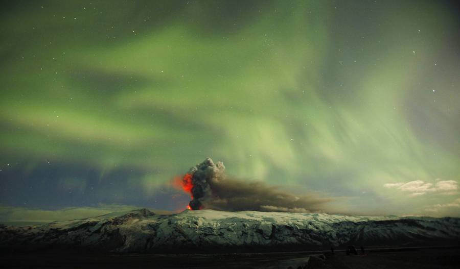
Eyjafjallajökull eruption: photo by Adam Rifkin at Flickr.com.
Bárðarbunga volcano woke up on the night of the 16th August and by six in the afternoon it had had over 300 earthquakes. Today there’s been more than 1200 of them, the strongest one that happened last night being strong enough to be felt all the way to Akureyri. Icelanders are keeping a careful eye on the area just in case there’s going to be an eruption, which no one really wants. Bárðarbunga, you see, is one of Iceland’s most dangerous and destructive volcanoes.
…for Icelanders, that is, even if things go via the worst case scenario it’s most likely only Iceland that’ll suffer for it. Bárðarbunga (= Bárður’s bump) is a sub-glacial volcano just like Eyjafjallajökull, which does mean ash in case the eruption pierces the ice layer, but just like with Grímsfjall’s eruption it doesn’t necessarily touch the aerial traffic outside of Iceland. Grímsfjall had heavy type of ash, Eyjafjallajökull’s ash was light and therefore spread easily over the sea. Bárðarbunga erupts every 250-600 years so there’s very little documentation on its ash type, but Grímsfjall belongs to the same volcanic system so we may assume the ash type could be the same. At the moment it’s not even certain whether the eruption will even happen, or if it does will it actually pierce the ice layer so it’s best to not panic.
Ash is poisonous to animals but humans can get by with face masks if things get really grainy, taping the windows and washing the cars asap after the fall. It’s nothing new for Icelanders and therefore not even among the first worries. Worse is that Bárðarbunga is huge, and lies under a glacier. Let’s look at the possible scenarios that Eldgos (link) listed:
HVAÐ GETUR GERST NÆST
(= What could happen next; Icelandic uses the verb “geta” to mean “could”, which can be a bit confusing since the verb “can” is “kunna“. However, “kunna” means only one type of “can” – being knowledgeable enough to do something or to know something. The “being able to” -meaning of “can” is “geta“.)
1. Virknin stöðvast. Þetta segja sumir jarðvísindamenn að sé líklegast í stöðunni.
(= Activity comes to a halt. This, say some geologists, may be the likeliest to happen.)
2. Gos norðaustur af Bárðarbungu, við mörk jökulsins. Besta mögulega niðurstaða ef gos verður á annað borð er að fá það á íslausu svæði norðan við jökulinn.
(= Eruption northeast of Bárðarbunga, on the edge outside of the glacier. Best possible outcome if an eruption is to happen is to have it happen on the iceless area on the north of the glacier.)
3. Gos austan til í kerfinu undir þykkum jökli. Þar hefðum við sprengigos undir jökli með tilheyrandi öskufalli og jökulhlaupi að öllum líkindum á vatnasviði Jökulsár á Fjöllum. Mjög stórt gos á þessu svæði mundi valda hamfaraflóði.
(= Eruption on the east side of the system under thick layer of ice. There we’d have an explosive eruption under the glacier with notable ash fall and most likely glacier floods in the water system of Jökulsár. A large eruption in this area could cause catastrophic floods.)
4. Kvikuhlaup til suðvesturs og gos í sprungusveimi Veiðivatna. “Worst case scenario” …og sem betur fer afar ólíklegt i stöðunni núna því engin virkni er sjáanleg í suðvesturhluta öskjunnar og reininni sem liggur til Veiðivatna.
(= A flood towards southwest and an eruption in the Veiðivatn fissure area. “Worst case scenario” …and thankfully very unlikely to occur now because no activity can be seen on the southeast side of Askja and route that leads to Veiðivatn.
So before you believe the media telling you Iceland’s trying to end the world again take a deep breath and have a look at these sites that are closely following the activity and can give you a more realistic idea of what the volcanic system really is capable of.
Hjörtur Smárason at Raving Ravens (link). English.
Haraldur Sigurðsson (link). Icelandic.
UPDATE: just as I was about to post this things changed a little. The status of the volcano went from yellow to orange and if the eruption will begin it will most likely do so suddenly. Veðurstofan is a great place for earthquake-watching (link) and I will also add information here if something interesting happens!
18.45: a web cam has been set to monitor Bárðarbunga. You can watch it here.
20.19: no sign of the shaking calming down though there’s as of yet no sign of an eruption breaking through the glacier either. The highland roads above Vatnajökull have been closed for all traffic including pedestrians, the areas can be seen here. The river Jökulsá has reportedly more water in it than would be usual for this time of the year. Want to see the earthquakes’ locations in 3D? Go here!
22.20: last update for tonight before I’m off to bed about how Iceland is informing the rest of the world – Reykjavik Grapevine gathers all the important parts of info into one tight package (in English) here, and MBL has also began to give out occasional English reports on the matter, here.
Tue 19. Aug
07.13: the morning shows nothing new and the volcano has now been shaking without a pause since Saturday. There are now more articles in English available about the earthquakes here and the possibility of the volcano erupting here. Another interesting 3D map of the eruptions (complete with possibility of seeing just how many have happened within f.ex. the last hour) can be found here.
11.00: situation is still the same. Currently measures are being taken to avoid losing the bridges near Vatnajökull in case of a glacier flood (last time this area flooded the water swept away 17km of the most important road of Iceland, Ring Road 1). 200 people are still reported to be in the area now closed (link).
13.50: new web cam added, this time one that you don’t have to keep refreshing (link)! Another useful place is the FB page of Almannavaradeild here. Currently traveling here or planning to? Safetravel (link) is keeping up with all of the info that’s important for travelers. Situation at Bárðarbunga has not changed during the day, it’s still level orange.
20.20: danger phase declared at Bárðarbunga. The area is being evacuated (link).
21.17: learn to pronounce Bárðarbunga here. 😀
Wed 20 Aug.
08.35: the area above Vatnajökull has been successfully evacuated. There are now earthquakes every minute in the area (link).
08.48: TF-SIF, a plane of the Coast Guard, flew over the glacier last night on its way back home from Sicily. You can see the material they managed to collect here.
22.29: no new news today, the situation is still very much the same. The earthquakes have not even slowed down and are moving in a straight line towards the northwest as can be seen here.
Thu 21 Aug
08.43: still no change, Bárðarbunga as shaky as before. We’ll just have to wait and see whether this volcanic activity will at some point melt its way through the glacier as happened with Grímsfjall in 2011, or eventually calm down underneath like happened with Katla, also in 2011. Here‘s again a compact info of where we presently are, in English. Icelanders are meanwhile getting steadily more amused by the foreign reactions and naturally tourists are being asked to pronounce Bárðarbunga (link).
14.27: hahahaha look what I found (link)! 😀 Er eldgos = is there a volcanic eruption.
Fri 22 Aug
08.41: something unusual happened last night – the largest earthquake yet, of 4,7 Richter (link). Since last night there have been a few strong ones again but overall nothing’s changed. Bárðarbunga is as lively as ever and shows no signs of either slowing down OR an imminent eruption.
Sat 23 Aug
09.19: for once the pattern of the earthquakes has slightly changed. They’re now a bit less in amount but there’s more of the larger ones, you can see here that they’re all happening on the same location (the larger earthquakes are marked with a star).
23.29: the volcano has been set to red alert meaning imminent or ongoing eruption. Regardless it’s not entirely certain yet whether or not an eruption is happening, or will happen – we’re told that the situation will be re-assessed tomorrow morning.
Sun 24 Aug
09.23: although yesterday the eruption was assumed to have begun no sign of it is yet to be seen. If you’re following the web cams of the area and saw a lot of what seemed to be smoke, alas, that was just a sandstorm (link). The red alert is still in effect and there’s no reason to lower it at the moment – here you can see the size of the no-flying area. No actual trouble o aerial traffic is expected at the moment. Most interestingly though, last night saw the largest earthquakes on the area yet, according to the Veðurstofa map two over 5 Richter (link)!
10.10: Míla has added a second camera for Bárðarbunga (link)!
10.33: correcting myself a little – the suspected eruption site is no longer at Bárðarbunga but Dyngjujökull, where ice is much thinner.
17.39: the red alert has been brought back to orange as no sign of eruption is yet seen. The earthquakes have grown in both size and frequency though. Grapevine has made an excellent post about volcanic activity in Iceland and its history and why you shouldn’t worry (link), bonus points for comparing the fame of Bárðarbunga to that of Justin Bieber. 😀
19.26: as you may know many Icelanders believe that some people are capable of seeing the future. One such person, Klara Tryggvadóttir (link), actually predicted earlier this week that the eruption would begin today either at seven in the morning or eleven at night. As we can tell from the Vedurstofan earthquake list the other one of the over 5 Richter earthquakes happened a little before six a.m. and now we’re waiting to see how well she could predict the intentions of the volcano!
21.45: while we wait to see if Klara was right, why not watch 15 years of earthquakes and volcanic eruptions in 4 minutes? (link) 🙂
Mon 25 Aug
09.25: no eruption yet in sight, although because of the glacier on top if and when it happens it’ll first have to melt its way through the ice. This will be seen first as huge dents, sigkatlar, in the ice as it collapses downward. You can see how they look like here. On a bit more worrisome news tourists are quite set to going as near the volcano as possible regardless of the danger. Thankfully the roads that lead to it are few and can be guarded, but apparently the guards now have to work in shifts to make sure no one sneaks past them (link).
22.10: today we had another one of those big, over 5 Richter earthquakes (link) but aside of that nothing else seems to be going on at the moment. This does follow Krafla, another volcano’s eruption pattern though, and the general consensus seems to be that the eruption is only a matter of time now. It’s important to stress though that there’s no way of telling what a volcano is planning to do, so we’ll just wait on our shaky little island for now. 🙂
Tue 26 Aug
09.31: the largest earthquake yet happened last night – 5,7 Richter! (link, link and link)
Wed 27 Aug
08.46: the earthquakes are again growing in both amount and force (link). No one currently alive has witnessed anything like this before according to the article here so naturally the local scientists are having some very interesting times – well, we all are to be honest. The earthquakes that originally began at Bárðarbunga seem to be moving towards mountain Askja in the north (link).
23.40: remember the dents and fractures in ice caused by earthquakes and/or the glacier melting from below, sigkatlar? They’re currently forming into the glacier – you can see a photo of one of them here!
Thu 28 Aug
08.13: the first signs of a possible eruption have arrived, those dents and cracks in the glacier. There’s still uncertainty about the state of things but here‘s what we know now, they’re currently 10-15m deep and form a 6-8 km long line in the ice. There’s also a heightened possibility of a glacier flood either north in Jökulsá or south over Skeiðarársand where it would damage the Ring Road 1. TF-SIF got this picture yesterday and is scheduled to fly over the area today at 9.00 a.m. so if anything new is found out I’ll let you know.
11.46: TF-SIF has returned – here‘s the report so far. A more detailed one will be released after the noon.
19.53: a very thorough look at the volcanic activity in the area though the times here. Meanwhile the aviation colour code map is getting, well, colourful! (link)
News articles about the situation:
Óvissustig vegna Bárðarbungu (= on uncertainty level because of Bárðarbunga). (link)
Eitt öflugasta og hættulegasta eldfjall Íslands (= one of the most powerful and dangerous volcanoes of Iceland). (link)
Bárðabunga geti valdið hamförum við Dettifoss (= Bárðarbunga could cause a disaster at Dettifoss). (link)
Vegum lokad á hálendinu af ótta við eldgos (= roads on the highlands closed for fear of eruption). (link)
Stærsti jarðskjálftinn til þessa (= the strongest earthquake thus far). (link)
Nokkurra klukkustunda fyrirvari yrði á eldgosi (=eruption may give only a few hours warning). (link)
Possible volcanic eruption in Iceland (link). This one’s in English.

Build vocabulary, practice pronunciation, and more with Transparent Language Online. Available anytime, anywhere, on any device.

About the Author: hulda
Hi, I'm Hulda, originally Finnish but now living in the suburbs of Reykjavík. I'm here to help you in any way I can if you're considering learning Icelandic. Nice to meet you!
Comments:
Hjörtur Smárason:
Thanks for the mention, Hulda, and a good coverage!
hulda:
@Hjörtur Smárason Actually, thank you for being one of the few writing about the situation in English! Most of my readers are studying Icelandic and some may not yet be able to read the Icelandic news articles, leaving them with only what the foreign media has to say about the possible eruption. It’s great to find texts that are both written from a local point of view and realistic.