Venezuela’s Natural Beauty: Región Zuliana Posted by Anais on Jun 30, 2021 in Travel & Geography
Dominating the northwestern part of Venezuela, la Región Zuliana comprises exclusively Zulia state, the most populated one in the country. Known for its cultural tradition, tropical climate and cultural diversity, the Zulian region and its capital city, Maracaibo, represent an essential piece of Venezuela’s natural and cultural landscape.
The diversity of natural landscapes present in Zulia, in addition to the presence of Lake Maracaibo, defines a wide range of climates present in the state, featuring highly irregular rain patterns.
There are two geographical features that have defined this region: the Maracaibo Lake basin, a depression covered with sediments coming from the Andes Mountain Range; and the Sierra de Perijá—also called Sierra de los Motilones—, a local, sparsely populated mountain range in the western part of the region, right on the border with Colombia.
Zulia comprises many habitats that provide interesting wildlife reservoirs, such as the Sierra de Perijá and the humid coastal environments, which have a great variety of species, even if some of them are still endangered as a result of the economic activities in this state, like deforestation, poaching or water pollution.
However, this region keeps attracting both national and foreign tourists for the many possibilities the state offers. Just by traveling around Castilletes—right in front of the Gulf of Venezuela—, one could find hundreds of appealing places to explore, like the haciendas (ranches), museums for local handicrafts and folkloric treasures, and historical monuments.
Zulia is home to four main Indigenous peoples (Guajiros, Wayuú, Yukpas, and Barí), which still maintain many of their traditions and lifestyles. For tourists, this is a genuine cultural experience.
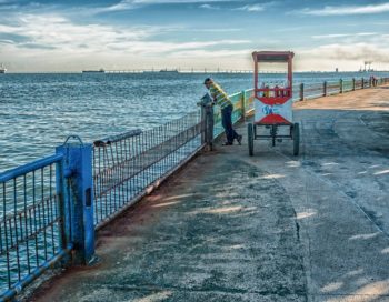
Also, the shores of Maracaibo Lake and the sea shores overlooking the Gulf of Venezuela offer wonderful beaches to travelers, as well as true architectural jewels from Venezuela’s colonial past, such as the San Carlos Castle, Castillete de Zapara and Paijana’s fortified outpost.
When compared with other Venezuelan regions, Zulia state doesn’t have a great array of national parks. Nonetheless, the two of them are very well-known as tourist magnets, especially for those looking for new, wild adventures.
The most well-know of those parks is the Sierra de Perijá National Park, officially created on December 12, 1978 in order to preserve the local biodiversity in an area of 295,288 hectares. With two hills standing out (Cerro Pintado and Cerro Tutari), the park extends through the municipalities of Perijá and Colón. Its height is enough to allow for the development of various climatic and vegetation levels, including páramos (high plateaus) and most of the protected area is covered by dense, humid forests and scrubs.
The other park, Ciénagas de Juan Manuel National Park, was established on June 5, 1991. Also known as Aguas Blancas and Aguas Negras, it is a wide swamp famous for el relámpago de Catatumbo (Catatumbo Lightning), an unique atmospheric phenomenon that happens over the mouth of the Catatumbo River originating from a mass of storm clouds at an altitude of more than 1 km, which appears at least 140 nights per year, nine hours per day, and from 16 to 40 times per minute—a lightning so famous it appears on the state’s official flag.
In brief, la Región Zuliana is one of the best regions to visit if you want to start exploring a really fascinating side of Venezuela’s landscape.

Build vocabulary, practice pronunciation, and more with Transparent Language Online. Available anytime, anywhere, on any device.


