

Catastrophic floods in Iceland. Posted by hulda on Oct 1, 2015 in Uncategorized
Vatnajökull + Twisted Bridge by Audrey at Flickr.
Living in a volcanic country is never predictable. When we’re talking about volcanoes and the dangers they bring along many people would probably get a very Pompeiian idea of what that means, but actually the real threat is not fire at all. It’s water.
Many of Iceland’s volcanoes are situated under glaciers, and when they start to warm up they melt the ice on top little by little until in the end the whole ice cap lifts up like a lid from a pot and lets out a huge flood. The worst ones of these floods take everything with them on their way and even smaller ones damage property and roads, threatening the Ring Road 1 in south Iceland. Besides the water another danger in the glacier floods is the possibility of poisonous gas that the water might bring along.
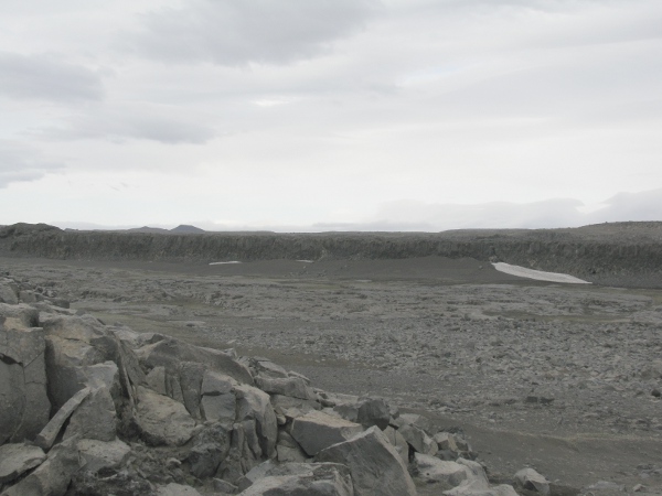
From up north at Dettifoss: probably the most catastrophic glacier flood of the history of Iceland happened here a long time ago, and this is what it left behind – rocks (and a majestic waterfall).
Iceland is currently having a massive glacier flood at Skaftá river, estimated to be larger and more powerful than any in the recent years; south Iceland is mostly uninhabited but alas, this flood might be nearing a populated area. People are likely not in danger but property and roads may be and this is a bad time of the year to have roads cut off.
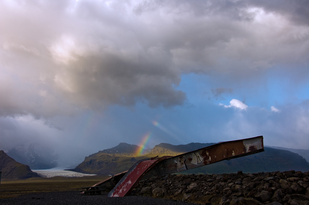
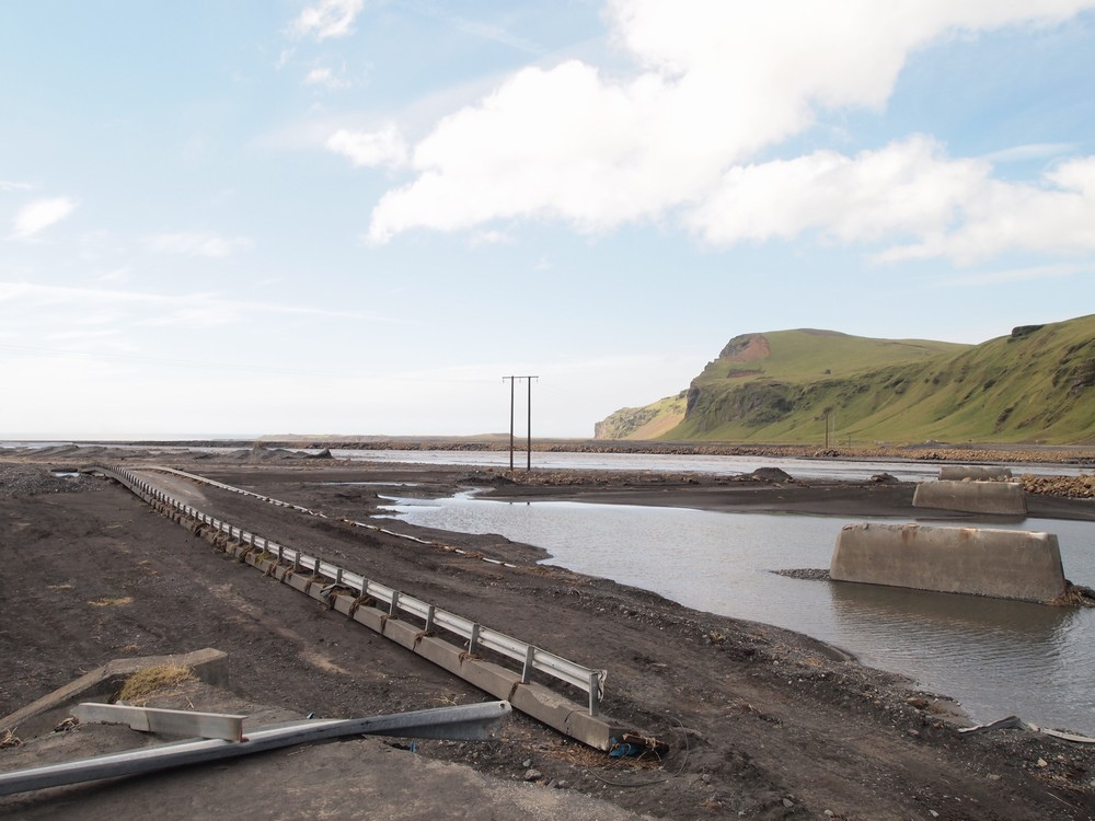
To give you an idea of the impact of the floods, here’s a monument – a glacier memento, if you like – of the destructive power within Vatnajökull glacier.
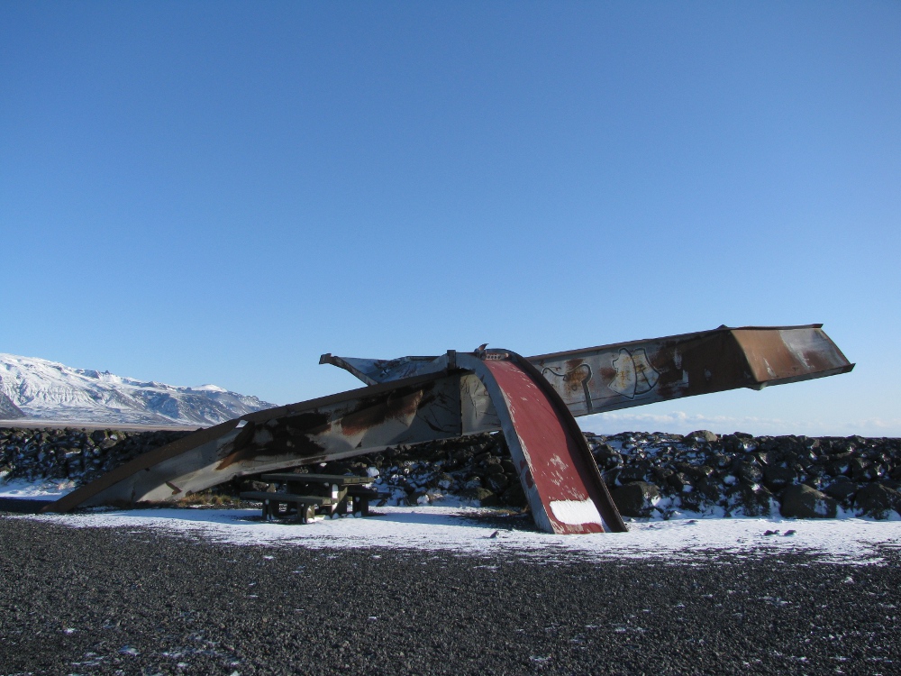
This used to be a long bridge. Now all that’s left of it is this one, twisted rusty thing, standing alone in the middle of the large, cold desert south of Vatnajökull.
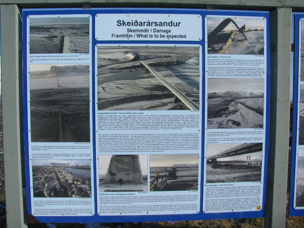
There’s also two signboards with photos of the flood while it was still going on.
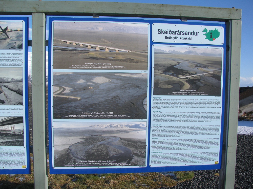
Here’s what the bridge used to look like, if you’d like to compare it to what’s now left of it. For views of the previous large glacier floods in Skaftá I found this Flickr tag here – when floods happen here they happen very thoroughly!
The current flood area is much more to the west, and we’re all following news on what’s going on in that part of Iceland. Travelers are being warned to not go near the flooded area and I can only hope the ban is effective, we’ve already lost more tourists to the powers of nature this year than we have of Icelanders.
Glacial river flood under way.
Glacier flood may reach national ring road.
Skaftá flood: “This could be very big”.
Flood to reach populated areas by midday.
LIVE: follow the sinking ice cap (here you can watch the ice cover under which the water’s flooding out slowly collapse).
The English news are obviously aimed at foreigners, so let’s also have a look at the media in Icelandic.
Destroyed bridge on Route 1 after Katla Jökulhlaup in july 2011 by Pavel Karaflát at Flickr.
Langt hlé gæti þýtt að hlaupið verði stórt (A long break may mean that the flood will be large).
This article discusses the possibility of a large flood comparing it to the previous years, where a break in the more or less regular slammer floods has always mean a big one is on its way. This article’s now two days old though, and today we know it’ll definitely be a large one. In fact –
Vöxtur Skaftárhlaupsins óvenjulega hraður (The Skaftár-flood is expanding unusually fast).
Í tilkynningu frá Veðurstofunni segir að rennsli við Sveinstind sé nú rúmir þúsund rúmmetrar á sekúndu og fari hratt vaxandi.
An announcement from the Met Office says that the flooding at Sveinstind is now about a thousand cubic metres by second and growing.
Fréttir Stöðvar 2 í kvöld: Hættustigi lýst yfir (News on Channel 2 tonight, alarm level announced).
“Allt bendir til þess að þetta sé mjög stórt hlaup og jafnvel stærsta hlaup sem að hefur komið úr kötlunum eftir að mælingar hófust sem var held ég 1971… …Meiri hætta þá á vegaskemmdum uppi í Skaftárdal… …og síðan náttúrlega eru þá orðnar auknar líkur á að það flæði hugsanlega yfir þjóðveg 1. Sem þýðir að það geti hugsanlega þurft að loka honum um einhvern tíma,” segir Víðir Reynisson.
“Everything’s pointing to a very large flood, possibly even the largest flood that has come from the calderas after measuring began that I think was in 1971… …More danger is of damage to roads up in Skaftárdal… …and then naturally it’s become more and more likely that it’ll flood considerably over national road 1. That means it may have to be closed for some time,” says Víðir Reynisson.
(For Icelanders the Ring Road 1 is a lifeline around the country, and though it’s cut somewhat regularly by the forces of nature it’s never to be taken lightly.)
Hættustigi lýst yfir (danger level announced). Here’s footage of the flood as it was earlier today – also a great chance to train your ear to Icelandic!

Build vocabulary, practice pronunciation, and more with Transparent Language Online. Available anytime, anywhere, on any device.

About the Author: hulda
Hi, I'm Hulda, originally Finnish but now living in the suburbs of Reykjavík. I'm here to help you in any way I can if you're considering learning Icelandic. Nice to meet you!