5 Things You Should Know About The First Westerstorm of 2018 Posted by Sten on Jan 5, 2018 in Dutch Vocabulary, News
In the last few days, we had some bad weer (weather) in the Netherlands. It is a country infamous for its rain and wind, but this was different. Actually, it was a storm so bad, that the term noodweer (“emergency weather”, severe weather) was used. What was going on? Find out below.
1. Windsnelheden boven 140 kilometer per uur!
It was the first westerstorm (west storm) of the year. Besides a lot of regen (rain), this storm also came with a lot of wind (wind). The result is hoge golven (high waves), but also zware windstoten (strong wind blasts). Wind is measured in Beaufort (BFT), a scale that ranges from 0 to 12. At 0, it is windstil (no wind), and at 12, you have an Orkaan (hurricane)! These are speeds above 117 km/h (73 mph)!
Usually, the Netherlands has winds about 4-5 BFT, which translates to less than 50 km/h (31 mph) windsnelheid (wind speed). In this storm, however, windsnelheden reached the top of the scale, with speeds of up to 141 km/h (88 mph)!
This was obviously quite dangerous. Such wind speeds can push the water into the country, and therefore quickly lead to flooding. The Netherlands was flooded before, with horrific consequences. An example is the Watersnoodramp van 1953.
So these wind speeds were quite alarming! But the Dutch have some protection.
2. Alle vijf grote waterkeringen dicht!
The Netherlands is a country which is mostly below the zeespiegel (sea level). This means that dijken (dykes), dammen (dams), waterkeringen (water barriers) and sluizen (sluices) and a myriad of other devices are required to keep the water out and the Dutch dry.
The Dutch have some of the most advanced water defense systems in the world.
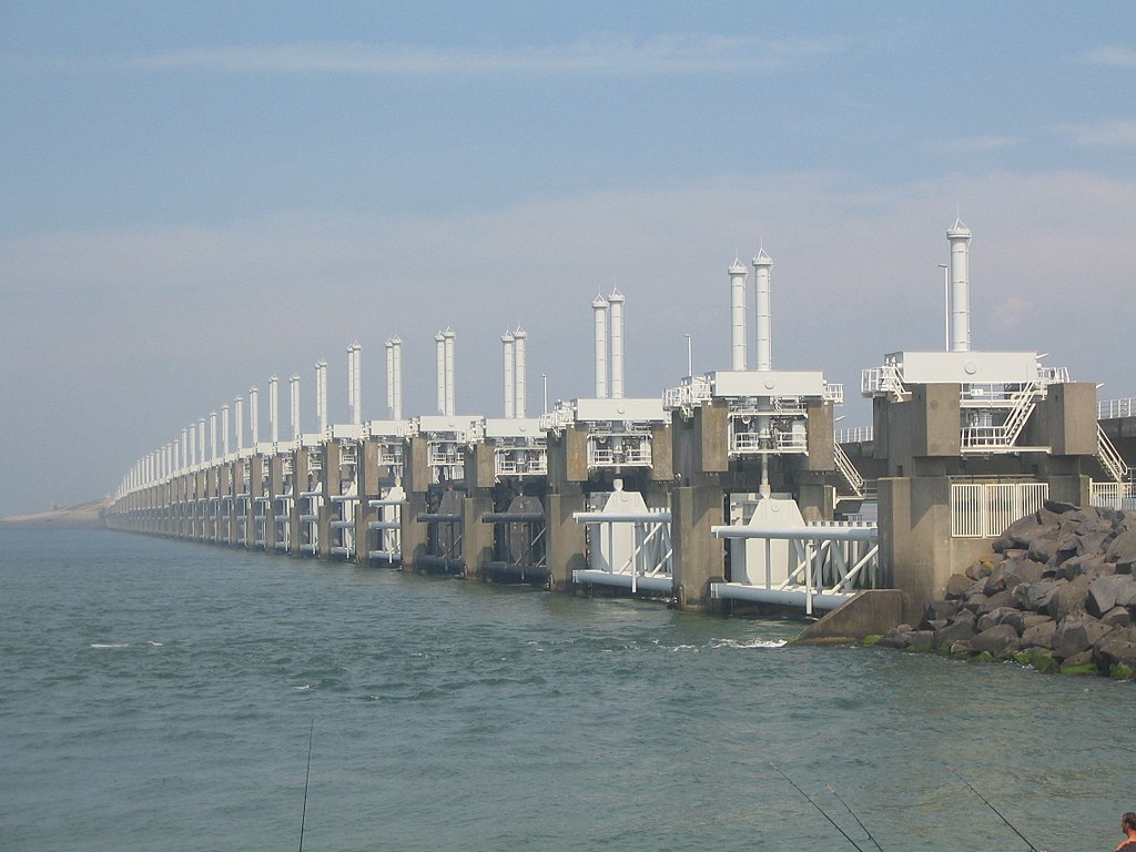
The severity of the storm was highlighted by the fact that all five large watervloedkeringen (water flood barriers) were closed, namely the Hartelkering, the Hollandsche IJsselkering, the Maeslantkering, the Oosterscheldekering and the balgstuw at Ramspol. It has never happened before that all five closed at the same time!
The first four watervloedkeringen are part of the Deltawerken (Delta Works), a project of 13 works that protect the Netherlands from the sea, and also declared one of the Seven Wonders of the Modern World by the American Society of Civil Engineers. Some very impressive bouwwerken (structures)!
Let’s have a closer look at the balgstuw at Ramspol.
The balgstuw (bellow barrage) is a barrier that closes automatically if the water is above 0.5m (3 ft) NAP (Normaal Amsterdams Peil), the Amsterdam Ordnance Datum, a measurement for the water level in the Netherlands. The unique barrage has three big air pillows that blow up to separate the water of the Ketelmeer (which is home to this strange island) from the water of the Zwarte Meer. It looks like a big fietsband (bike tube)! This way, overstromingen (floods) can be prevented. Read (and watch) all about this interesting balgstuw here.
3. Code Oranje
Rijkswaterstaat, the Dutch authority that oversees storms and also controls the large water barriers, issues a warning to other water barrier authorities about the severity of storms and the impact on the NAP, so they can plan ahead. This warning is based on the so-called kleurcodes (color codes) of the KNMI (Dutch Meteorological Institute), which range from groen (green), geel (yellow), oranje (orange) to rood (red). Red is the most severe, and is the only code that indicates an official weeralarm (weather alarm).
Usually, the Netherlands has a weather code of either groen or geel. Those don’t any noteworthy weather. In the recent days, the KNMI issued code oranje, which is only issued if there will be at least 75 mm of rain in the following 24 hours and wind speeds of more than 100 km/h (62 mph).
The fact that a weeralarm was not given shows that the authorities were able to quickly get control over the situation. Good job!
4. Treinen en vliegtuigen vertraagd
Still, treinen (trains) and vliegtuigen (airplanes) were vertraagd (delayed) or even geannuleerd (cancelled). With the winds, it is no wonder that vliegtuigen are delayed, or that it is deemed too dangerous to even get into the air. In the video above, you can see how a pilot during the storm decided that it was too dangerous to land and he made a doorstart (go-around) and try again.
Also trains and cars had issues with the wind, because many falling trees blocked the road. All in all, however, the Dutch came out of the storm unscathed. There was a lot of damaged property, but nobody was severely wounded or killed in the storm.
5. Hoe onstaan windstoten?
https://www.youtube.com/watch?v=Xcmi-AAap8s
How do such windstoten come into existence? The weatherman of the Dutch NOS news, Peter Kuipers Munneke, explains.
Did you hear about this storm in your country? If you were in the Netherlands, how did you experience it? Let me know in the comments below!

Build vocabulary, practice pronunciation, and more with Transparent Language Online. Available anytime, anywhere, on any device.


Comments:
Peter Simon:
Hi Sten, excellent information. I experienced something quite similar when I flew from Eindhoven (where buses to the airport disappeared for several hours due to a bit of snow before and passengers were not even informed!) to Budapest at the beginning of December. In Budapest, surprisingly, we had such strong winds below 200 metres that we couldn’t land first, had to make a circle like you say above. It was quite scary but we managed to land at the second attempt, but the side wind was still very strong and disturbing until we slowed down.
Otherwise, later, after I returned, end-of-December winds here in Gelderland were not so strong, my guess was usually around 6-7 BFT. No serious consequences.
Cheers!
Sten:
@Peter Simon Wow, that must be quite an experience! Sounds like quite a scary experience in the airplane… Good to hear you got out there unharmed!
Yeah, 6-7 BFT should be quite normal 🙂 No Big Deal!
Thanks for the comment!